|
search place name
|
||
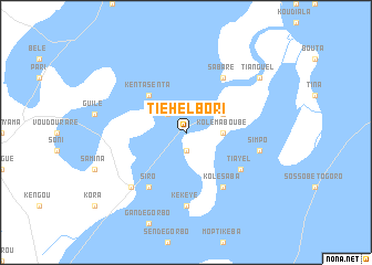
Tiéhel Bori (Mali)Tiéhel Bori is a town in Mali. An overview map of the region around Tiéhel Bori is displayed below.
regional and 3d topo map of Tiéhel Bori, Mali ::
Tiéhel Bori airports ::
The nearest airport is MZI - Mopti Ambodedjo, located 78.2 km east of Tiéhel Bori.
Nearby towns ::
Boukari (1.9km south) //
Kenta Foulbé (2.6km north west) //
Kolé Maboubé (3.6km east) //
Diondiori (4.0km north east) //
Kaya (5.2km north west) //
Kenta Senta (5.2km north west) //
Siro (6.6km south west) //
Kolé Saba (6.6km south east) //
Tiayel (6.5km south east) //
Sabaré (6.6km north east) //
Kékèye (7.4km south) //
Simpo (7.4km east) //
Kondo (7.7km south west) //
Tianguel (9.1km north east) //
Ouro Boubou (9.1km north east) //
[all distances 'as the bird flies' and approximate] 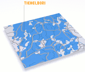 Places with similar names to Tiéhel Bori, Mali ::
// Dhaluābāri (BD)
Disclaimer :: Information on this page comes without warranty of any kind |
||
|
Where is Tiéhel Bori? Elevation and coordinates ::
Latitude (lat): 14°36'0"N Longitude (lon): 4°48'0"W
Elevation (approx.): 268m (map arrows pan, magnifying glasses zoom) |
||
|
Visiting Tiéhel Bori? Hotel/Accommodation ::
Book a hotel in Tiéhel Bori Travel Guide ::
Buy a travel guide for Mali rental cars ::
car rental offers GPS waypoint ::
download a GPX waypoint (PoI) of Tiéhel Bori for your GPS receiver
|
||