|
search place name
|
||
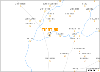
Tinntiba (Mali)Tinntiba is a town in Mali. An overview map of the region around Tinntiba is displayed below.
regional and 3d topo map of Tinntiba, Mali ::
Tinntiba airports ::
The nearest airport is KYS - Kayes Dag Dag, located 83.9 km north west of Tinntiba.
Other airports nearby include SEY - Selibabi Selibady (199.8 km north west), BXE - Bakel (201.4 km north west), KGG - Kedougou (215.4 km south west), Nearby towns ::
Diawarantourou (0.0km north) //
Ségala (3.6km east) //
Farafiné (5.6km north) //
Kolinnguémou (6.6km north west) //
Farako (7.4km north) //
Kétiou (7.4km west) //
Barafoto (8.1km north west) //
Kambonia (9.2km south east) //
Sololomou (9.1km north west) //
Modibaya (10.3km north east) //
[all distances 'as the bird flies' and approximate] 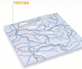 Places with similar names to Tinntiba, Mali ::
Disclaimer :: Information on this page comes without warranty of any kind |
||
|
Where is Tinntiba? Elevation and coordinates ::
Latitude (lat): 13°58'0"N Longitude (lon): 10°50'0"W
Elevation (approx.): 119m (map arrows pan, magnifying glasses zoom) |
||
|
Visiting Tinntiba? Hotel/Accommodation ::
Book a hotel in Tinntiba Travel Guide ::
Buy a travel guide for Mali rental cars ::
car rental offers GPS waypoint ::
download a GPX waypoint (PoI) of Tinntiba for your GPS receiver
|
||