|
search place name
|
||
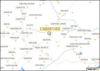
Cabo Atipo (Nampula, Mozambique)Cabo Atipo is a town in the Nampula region of Mozambique. An overview map of the region around Cabo Atipo is displayed below.
regional and 3d topo map of Cabo Atipo, Mozambique ::
Cabo Atipo airports ::
The nearest airport is APL - Nampula, located 159.8 km north of Cabo Atipo.
Nearby towns ::
Sózinho (2.9km south) //
Cabo Mucalavana (3.5km south east) //
Chefe Ossufo (4.1km north) //
Chefe Selimane (4.6km north east) //
Munica (4.9km east) //
Chefe Quecereia (5.0km south east) //
Tomás (5.2km east) //
Régulo Soalé (6.3km south west) //
Faria (6.8km north east) //
Fermento (6.6km east) //
Tonhia (7.0km south) //
Canlaua (7.1km south west) //
Chefe Metano (7.4km south) //
Cantoneiro (7.9km north) //
Latifo (7.7km west) //
Chefe Cavina (8.3km south west) //
Chefe Marido (8.3km north west) //
Chefe Alite (8.3km west) //
Cabo Mucalaia (9.1km north east) //
Mulama (9.0km north east) //
Muluça (9.8km north east) //
Cabo Cairali (9.7km south east) //
Cabo Apacari (10.4km south west) //
Muitumi (11.8km north east) //
[all distances 'as the bird flies' and approximate] 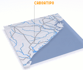 Places with similar names to Cabo Atipo, Mozambique ::
// Kabatepe (TR)
Disclaimer :: Information on this page comes without warranty of any kind |
||
|
Where is Cabo Atipo? Elevation and coordinates ::
Latitude (lat): 16°32'57"S Longitude (lon): 39°19'23"E
Elevation (approx.): 36m (map arrows pan, magnifying glasses zoom) |
||
|
Visiting Cabo Atipo? Hotel/Accommodation ::
Book a hotel in Cabo Atipo Travel Guide ::
Buy a travel guide for Mozambique rental cars ::
car rental offers GPS waypoint ::
download a GPX waypoint (PoI) of Cabo Atipo for your GPS receiver
|
||