|
search place name
|
||
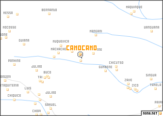
Camocamo (Maputo, Mozambique)Camocamo is a town in the Maputo region of Mozambique. An overview map of the region around Camocamo is displayed below.
regional and 3d topo map of Camocamo, Mozambique ::
Camocamo airports ::
The nearest airport is SZK - Skukuza, located 102.3 km south west of Camocamo.
Other airports nearby include HDS - Hoedspruit Afb (142.0 km west), PHW - Phalaborwa (143.6 km north west), MPM - Maputo (161.4 km south), Nearby towns ::
Uachilengue (0.6km south) //
Badia (2.5km north west) //
Davannane (2.7km north east) //
Macháche (5.0km west) //
Muqueviça (5.2km north west) //
Gumbene (5.8km south east) //
Mangani (6.1km north east) //
Guoiácue (5.8km west) //
Chicutso (7.6km east) //
Gemisse (7.9km east) //
Madanguane (8.2km south west) //
Buco (8.3km south west) //
Uachangua (9.0km south west) //
Julião (11.0km south west) //
[all distances 'as the bird flies' and approximate]  Places with similar names to Camocamo, Mozambique ::
Disclaimer :: Information on this page comes without warranty of any kind |
||
|
Where is Camocamo? Elevation and coordinates ::
Latitude (lat): 24°28'6"S Longitude (lon): 32°26'40"E
Elevation (approx.): 97m (map arrows pan, magnifying glasses zoom) |
||
|
Visiting Camocamo? Hotel/Accommodation ::
Book a hotel in Camocamo Travel Guide ::
Buy a travel guide for Mozambique rental cars ::
car rental offers GPS waypoint ::
download a GPX waypoint (PoI) of Camocamo for your GPS receiver
|
||