|
search place name
|
||
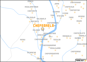
Chefe Amela (Zambézia, Mozambique)Chefe Amela is a town in the Zambézia region of Mozambique. An overview map of the region around Chefe Amela is displayed below.
regional and 3d topo map of Chefe Amela, Mozambique ::
Chefe Amela airports ::
The nearest airport is APL - Nampula, located 161.4 km north of Chefe Amela.
Nearby towns ::
Impachiua (2.8km south) //
Chefe Mucaveia (2.7km north east) //
Chefe Nemua (2.9km south) //
Peleque (2.9km west) //
Régulo Mutana (3.2km south east) //
Mulequela (4.4km north) //
Chefe Inrranha (4.6km south) //
Suli (4.5km south east) //
Chefe Apacar (4.7km north east) //
Muicheco (4.9km north west) //
Chefe Muieva (5.0km south east) //
Nicanga (5.5km south) //
Nunacola (6.1km south) //
Namiquela (6.2km south east) //
Tomé (7.0km north east) //
Afonso (6.9km north west) //
Muligudje (7.1km north west) //
Tocolôa (7.3km south east) //
Chefe Muauanha (7.5km south) //
Chefe Meta (9.0km north west) //
Atecume (9.0km north east) //
Nicopari (9.2km north east) //
Régulo João (9.7km south east) //
[all distances 'as the bird flies' and approximate]  Places with similar names to Chefe Amela, Mozambique ::
// Cheghā Meleh (IR)
// Chifumbula (ZM)
// Chefe Imala (MZ)
// Chefe Maala (MZ)
// Chefe Maliua (MZ)
// Chefe Mele (MZ)
// Chefe Muaile (MZ)
// Chefe Muala (MZ)
// Chefe Muala (MZ)
// Chefe Muala (MZ)
Disclaimer :: Information on this page comes without warranty of any kind |
||
|
Where is Chefe Amela? Elevation and coordinates ::
Latitude (lat): 16°32'18"S Longitude (lon): 38°59'55"E
Elevation (approx.): 41m (map arrows pan, magnifying glasses zoom) |
||
|
Visiting Chefe Amela? Hotel/Accommodation ::
Book a hotel in Chefe Amela Travel Guide ::
Buy a travel guide for Mozambique rental cars ::
car rental offers GPS waypoint ::
download a GPX waypoint (PoI) of Chefe Amela for your GPS receiver
|
||