|
search place name
|
||
Chefe Bubula (Inhambane, Mozambique)Chefe Bubula is a town in the Inhambane region of Mozambique. An overview map of the region around Chefe Bubula is displayed below.
regional and 3d topo map of Chefe Bubula, Mozambique ::

Chefe Bubula airports ::
The nearest airport is INH - Inhambane, located 107.3 km north east of Chefe Bubula.
Nearby towns ::
Cat. Met. Jone Mapipe (0.7km east) //
Tomás Dodé (1.9km south) //
L. Chicoenhane (1.9km north west) //
Chefe Mabongo (2.6km north east) //
Cabo Majongota (3.3km north) //
D. Muchai (3.5km south west) //
Nhagoela (3.7km south) //
Cat. Metodista (3.4km east) //
N. Dique (3.5km south west) //
Mateus Comi (4.1km south) //
Chefe Neve (4.0km south east) //
Mejoote (4.3km north east) //
N. Samuel (5.0km north west) //
Chefe Lixanga (4.7km west) //
Chefe Ancoca (5.2km north) //
Aldeia Macasse (5.4km north) //
D. Mavia (5.4km south) //
Pedro Uinge (5.6km south east) //
Maambo (5.6km north east) //
Regedor Guamba Pequeno (5.9km north east) //
Chilembe Malele (6.2km north) //
Chefe Chihuho (6.3km north east) //
Chefe Dacanela (6.2km east) //
Fassele Catine (6.2km east) //
Chefe Nhamuenda (6.8km south west) //
Jaime Naeme (7.0km south east) //
Chefe Chicopa (6.9km east) //
M. Lixanga (6.9km west) //
N. Tandamusse (7.6km south) //
[all distances 'as the bird flies' and approximate] 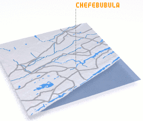 Places with similar names to Chefe Bubula, Mozambique :: Disclaimer :: Information on this page comes without warranty of any kind |
||
|
Where is Chefe Bubula? Elevation and coordinates ::
Latitude (lat): 24°31'16"S Longitude (lon): 34°37'15"E
Elevation (approx.): 57m (map arrows pan, magnifying glasses zoom) |
||
|
Visiting Chefe Bubula? Hotel/Accommodation ::
Book a hotel in Chefe Bubula Travel Guide ::
Buy a travel guide for Mozambique rental cars ::
car rental offers GPS waypoint ::
download a GPX waypoint (PoI) of Chefe Bubula for your GPS receiver
|
||