|
search place name
|
||
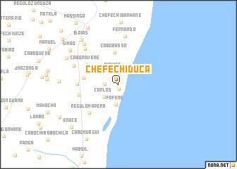
Chefe Chiduca (Inhambane, Mozambique)Chefe Chiduca is a town in the Inhambane region of Mozambique. An overview map of the region around Chefe Chiduca is displayed below.
regional and 3d topo map of Chefe Chiduca, Mozambique ::
Chefe Chiduca airports ::
The nearest airport is INH - Inhambane, located 51.0 km south of Chefe Chiduca.
Other airports nearby include VNX - Vilankulu Vilankulo (155.4 km north), Nearby towns ::
Guiducua (0.7km south) //
Niquice (2.1km north) //
Cabo Gadi (2.0km west) //
Carlos (2.9km south west) //
Fafene (3.2km south) //
Cabo Basso (5.1km north) //
Cabo Chissidane (5.2km west) //
Cabo Rovene (5.7km north west) //
Cabo Haque (6.0km west) //
Régulo Mapera (6.2km south west) //
Malova (6.0km west) //
Fernando (7.7km north) //
Cabo Guizugo (7.2km north west) //
Massetela (7.5km north west) //
Cabo Chilácua (8.1km north west) //
Queme (8.6km north west) //
Isaías (8.9km north west) //
Simão (8.8km north west) //
Enoce (9.5km south west) //
Cabo Muagui (9.8km south west) //
Alberto (10.9km north west) //
[all distances 'as the bird flies' and approximate]  Places with similar names to Chefe Chiduca, Mozambique ::
// Siovi Shuatak (US)
Disclaimer :: Information on this page comes without warranty of any kind |
||
|
Where is Chefe Chiduca? Elevation and coordinates ::
Latitude (lat): 23°25'0"S Longitude (lon): 35°26'33"E
Elevation (approx.): 53m (map arrows pan, magnifying glasses zoom) |
||
|
Visiting Chefe Chiduca? Hotel/Accommodation ::
Book a hotel in Chefe Chiduca Travel Guide ::
Buy a travel guide for Mozambique rental cars ::
car rental offers GPS waypoint ::
download a GPX waypoint (PoI) of Chefe Chiduca for your GPS receiver
|
||