|
search place name
|
||
Chefe Nhampalela (Inhambane, Mozambique)Chefe Nhampalela is a town in the Inhambane region of Mozambique. An overview map of the region around Chefe Nhampalela is displayed below.
regional and 3d topo map of Chefe Nhampalela, Mozambique ::

Chefe Nhampalela airports ::
The nearest airport is INH - Inhambane, located 47.8 km north of Chefe Nhampalela.
Nearby towns ::
Cabo Xuxululo (0.5km west) //
Cat. Metodista (2.7km south) //
Induna Gove (3.4km north east) //
Xuxululo (4.2km north east) //
Cabo Cuaguana (6.8km south west) //
Cabo Rava (6.8km north west) //
Cabo Licaca (8.1km north) //
Chefe Tualufo (8.3km north) //
J. Guiloiane (8.1km north east) //
Queletane (8.1km west) //
Chefe Massuanhe (8.1km west) //
The Ravene Estates (9.1km north west) //
Chefe Zuande (9.3km south west) //
Chefe Nhapalo (9.3km south west) //
Cat. Met. Livre (9.9km north west) //
Ligogo (10.5km north east) //
Bando Taimo (10.7km north east) //
Chefe Tungula (10.9km south west) //
Met. Livre Aldeia Cumbana (11.2km north west) //
[all distances 'as the bird flies' and approximate] 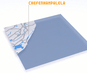 Places with similar names to Chefe Nhampalela, Mozambique :: Disclaimer :: Information on this page comes without warranty of any kind |
||
|
Where is Chefe Nhampalela? Elevation and coordinates ::
Latitude (lat): 24°17'55"S Longitude (lon): 35°18'33"E
Elevation (approx.): 115m (map arrows pan, magnifying glasses zoom) |
||
|
Visiting Chefe Nhampalela? Hotel/Accommodation ::
Book a hotel in Chefe Nhampalela Travel Guide ::
Buy a travel guide for Mozambique rental cars ::
car rental offers GPS waypoint ::
download a GPX waypoint (PoI) of Chefe Nhampalela for your GPS receiver
|
||