|
search place name
|
||
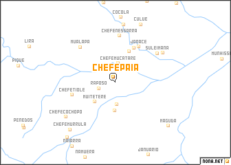
Chefe Paia (Niassa, Mozambique)Chefe Paia is a town in the Niassa region of Mozambique. An overview map of the region around Chefe Paia is displayed below.
regional and 3d topo map of Chefe Paia, Mozambique ::
Chefe Paia airports ::
The nearest airport is VXC - Lichinga, located 241.9 km north west of Chefe Paia.
Nearby towns ::
Raposo (2.8km west) //
Chefe Mucatare (3.1km north) //
Chefe Nicanhaba (3.6km south) //
Marques (4.5km south) //
Muitetere (4.6km south west) //
Dinis (5.5km north east) //
Matare (6.3km north east) //
Jonace (6.8km north east) //
Chefe Tiole (7.1km west) //
Chefe Nessarra (7.6km north) //
Mualapa (8.0km north west) //
Suleimana (8.1km north east) //
Nipata (8.9km north east) //
Chefe Cochopo (9.6km south west) //
Chefe Murrula (10.5km south west) //
Maguda (11.0km south east) //
Couto (11.7km south west) //
[all distances 'as the bird flies' and approximate] 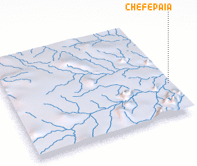 Places with similar names to Chefe Paia, Mozambique ::
Disclaimer :: Information on this page comes without warranty of any kind |
||
|
Where is Chefe Paia? Elevation and coordinates ::
Latitude (lat): 14°39'56"S Longitude (lon): 36°59'36"E
Elevation (approx.): 529m (map arrows pan, magnifying glasses zoom) |
||
|
Visiting Chefe Paia? Hotel/Accommodation ::
Book a hotel in Chefe Paia Travel Guide ::
Buy a travel guide for Mozambique rental cars ::
car rental offers GPS waypoint ::
download a GPX waypoint (PoI) of Chefe Paia for your GPS receiver
|
||