|
search place name
|
||
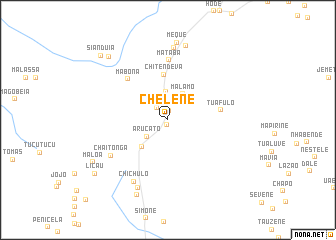
Chelene (Manica, Mozambique)Chelene is a town in the Manica region of Mozambique. An overview map of the region around Chelene is displayed below.
regional and 3d topo map of Chelene, Mozambique ::
Chelene airports ::
The nearest airport is BEW - Beira, located 169.3 km north east of Chelene.
Other airports nearby include BFO - Chiredzi Buffalo Range (210.2 km west), VNX - Vilankulu Vilankulo (237.0 km south east), Nearby towns ::
Manasse (0.6km south) //
Capitine (1.1km north) //
Seda (1.8km north west) //
Meque (2.0km north) //
Arucato (2.9km south west) //
Magouguane (3.1km north) //
Malamo (3.3km north east) //
Butiro (4.1km south west) //
Chitendeva (5.1km north) //
Tuafulo (5.7km east) //
Mabona (6.2km north west) //
Mataba (6.7km north) //
Chaitonga (7.2km south west) //
Chichulo (7.8km south west) //
Joane (8.1km north) //
Chiutesaca (8.3km south) //
Mataba (8.5km north) //
Meque (8.7km north) //
Mutaringo (9.0km south) //
Malôa (9.1km south west) //
Chimbai (9.4km north west) //
Licau (9.7km south west) //
Sianduia (10.0km north west) //
[all distances 'as the bird flies' and approximate] 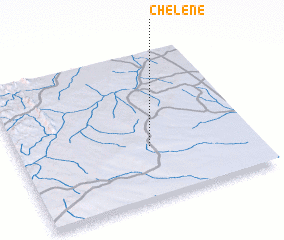 Places with similar names to Chelene, Mozambique ::
Disclaimer :: Information on this page comes without warranty of any kind |
||
|
Where is Chelene? Elevation and coordinates ::
Latitude (lat): 20°38'45"S Longitude (lon): 33°33'38"E
Elevation (approx.): 272m (map arrows pan, magnifying glasses zoom) |
||
|
Visiting Chelene? Hotel/Accommodation ::
Book a hotel in Chelene Travel Guide ::
Buy a travel guide for Mozambique rental cars ::
car rental offers GPS waypoint ::
download a GPX waypoint (PoI) of Chelene for your GPS receiver
|
||