|
search place name
|
||
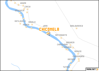
Chicomela (Gaza, Mozambique)Chicomela is a town in the Gaza region of Mozambique. An overview map of the region around Chicomela is displayed below.
regional and 3d topo map of Chicomela, Mozambique ::
Chicomela airports ::
The nearest airport is PHW - Phalaborwa, located 141.4 km south west of Chicomela.
Other airports nearby include HDS - Hoedspruit Afb (184.2 km south west), LTA - Tzaneen (205.3 km south west), SZK - Skukuza (218.8 km south), Nearby towns ::
Chaqui (1.1km north west) //
Chefe Mukatxana (2.3km north) //
Jone (3.1km north west) //
Matzequete (4.1km east) //
Chefe John (6.2km south east) //
Licóse (6.9km north west) //
Mauela (7.4km north west) //
Assane (7.8km south east) //
Maguaza (8.1km south east) //
Zindava (8.2km south east) //
Paposêco (11.8km north west) //
[all distances 'as the bird flies' and approximate] 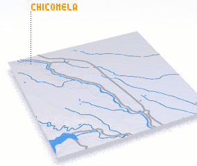 Places with similar names to Chicomela, Mozambique ::
// Chak Kamāl (PK)
// Chak Kamal (BD)
// Chak Mālla (BD)
// Chiquimula (GT)
// Chak Malā (IN)
// Chicamole (MX)
// Shakombela (ZM)
// Shakumbila (ZM)
// Shakumbila (ZM)
// Shikombola (ZM)
Disclaimer :: Information on this page comes without warranty of any kind |
||
|
Where is Chicomela? Elevation and coordinates ::
Latitude (lat): 23°3'23"S Longitude (lon): 32°9'29"E
Elevation (approx.): 124m (map arrows pan, magnifying glasses zoom) |
||
|
Visiting Chicomela? Hotel/Accommodation ::
Book a hotel in Chicomela Travel Guide ::
Buy a travel guide for Mozambique rental cars ::
car rental offers GPS waypoint ::
download a GPX waypoint (PoI) of Chicomela for your GPS receiver
|
||