|
search place name
|
||
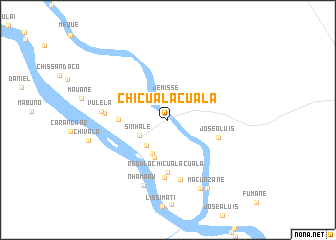
Chicualacuala (Gaza, Mozambique)Chicualacuala is a town in the Gaza region of Mozambique. An overview map of the region around Chicualacuala is displayed below.
regional and 3d topo map of Chicualacuala, Mozambique ::
Chicualacuala airports ::
The nearest airport is PHW - Phalaborwa, located 165.1 km south of Chicualacuala.
Other airports nearby include BFO - Chiredzi Buffalo Range (170.6 km north), LTA - Tzaneen (201.4 km south west), HDS - Hoedspruit Afb (213.7 km south), Nearby towns ::
Oliveira (2.1km north) //
Jemisse (2.6km north) //
Sinhale (3.4km south west) //
Chebeane (3.6km south west) //
Pani (4.0km south west) //
Uachamela (4.4km south) //
Nafamele (5.1km west) //
Regulo Chicualacuala (5.9km south) //
José A. Luis (5.6km east) //
Guezane (6.4km south) //
Pongonhe (6.8km south) //
Julai (6.6km west) //
Vulela (6.9km west) //
Nhamaau (7.8km south) //
Macassane (8.3km south east) //
Chefe Macassane (8.3km south east) //
Macunzane (8.7km south east) //
Chivalo (8.5km west) //
[all distances 'as the bird flies' and approximate] 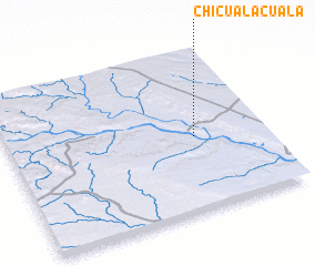 Places with similar names to Chicualacuala, Mozambique ::
Disclaimer :: Information on this page comes without warranty of any kind |
||
|
Where is Chicualacuala? Elevation and coordinates ::
Latitude (lat): 22°32'33"S Longitude (lon): 31°43'31"E
Elevation (approx.): 166m (map arrows pan, magnifying glasses zoom) |
||
|
Visiting Chicualacuala? Hotel/Accommodation ::
Book a hotel in Chicualacuala Travel Guide ::
Buy a travel guide for Mozambique rental cars ::
car rental offers GPS waypoint ::
download a GPX waypoint (PoI) of Chicualacuala for your GPS receiver
|
||