|
search place name
|
||
Chigugo (Gaza, Mozambique)Chigugo is a town in the Gaza region of Mozambique. An overview map of the region around Chigugo is displayed below.
regional and 3d topo map of Chigugo, Mozambique ::

Chigugo airports ::
The nearest airport is MPM - Maputo, located 149.0 km south of Chigugo.
Other airports nearby include SZK - Skukuza (153.0 km west), PHW - Phalaborwa (209.3 km west), MTS - Manzini Matsapha (272.7 km south west), Nearby towns ::
Armazém (2.7km south) //
Aldeia de Folgares (3.8km south east) //
Aldeia de Sagres (5.5km south west) //
Aldeia de Freixiel (6.1km north east) //
Aldeia S. Tiago (6.5km south east) //
Aldeia de Lionde (7.7km north) //
Franque (7.4km south east) //
Uacavilande (7.5km east) //
Armazéns (8.4km south) //
Chipapa (8.3km north east) //
Nôa (8.6km north east) //
António (8.5km north east) //
Muei (8.5km east) //
[all distances 'as the bird flies' and approximate] 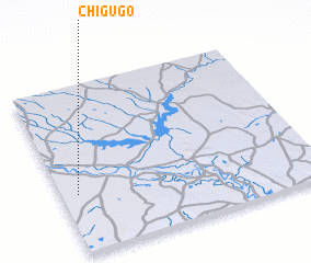 Places with similar names to Chigugo, Mozambique ::
Disclaimer :: Information on this page comes without warranty of any kind |
||
|
Where is Chigugo? Elevation and coordinates ::
Latitude (lat): 24°39'7"S Longitude (lon): 33°3'50"E
Elevation (approx.): 27m (map arrows pan, magnifying glasses zoom) |
||
|
Visiting Chigugo? Hotel/Accommodation ::
Book a hotel in Chigugo Travel Guide ::
Buy a travel guide for Mozambique rental cars ::
car rental offers GPS waypoint ::
download a GPX waypoint (PoI) of Chigugo for your GPS receiver
|
||