|
search place name
|
||
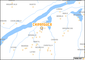
Chipanduca (Cabo Delgado, Mozambique)Chipanduca is a town in the Cabo Delgado region of Mozambique. An overview map of the region around Chipanduca is displayed below.
regional and 3d topo map of Chipanduca, Mozambique ::
Chipanduca airports ::
The nearest airport is MZB - Mocimboa Da Praia, located 99.9 km east of Chipanduca.
Other airports nearby include MYW - Mtwara (111.4 km north east), POL - Pemba (239.5 km south east), Nearby towns ::
Chinganda (0.9km south west) //
Gochela (1.0km north) //
Catiambica (1.2km west) //
Tungagê (1.2km north east) //
Lassine (2.6km south west) //
Lipulo (2.8km north east) //
Cuiganga (3.3km south west) //
Adremane (4.2km south west) //
Mungaula (5.5km south west) //
Nametil (6.8km south) //
Omar (7.3km south) //
Chipendi (7.7km south east) //
Mussa (7.9km south west) //
Chiputula (8.3km south) //
Nechacha (9.0km south) //
Uaalucueo (9.0km south) //
Saide (9.0km south west) //
Bambila (9.3km north east) //
Selemante (10.6km south west) //
Navanga (11.0km south west) //
Lipandi (11.1km north east) //
[all distances 'as the bird flies' and approximate]  Places with similar names to Chipanduca, Mozambique :: Disclaimer :: Information on this page comes without warranty of any kind |
||
|
Where is Chipanduca? Elevation and coordinates ::
Latitude (lat): 11°4'34"S Longitude (lon): 39°29'15"E
Elevation (approx.): 205m (map arrows pan, magnifying glasses zoom) |
||
|
Visiting Chipanduca? Hotel/Accommodation ::
Book a hotel in Chipanduca Travel Guide ::
Buy a travel guide for Mozambique rental cars ::
car rental offers GPS waypoint ::
download a GPX waypoint (PoI) of Chipanduca for your GPS receiver
|
||