|
search place name
|
||
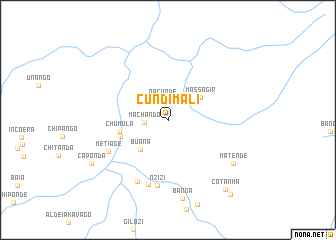
Cundimali (Niassa, Mozambique)Cundimali is a town in the Niassa region of Mozambique. An overview map of the region around Cundimali is displayed below.
regional and 3d topo map of Cundimali, Mozambique ::
Cundimali airports ::
The nearest airport is VXC - Lichinga, located 49.4 km south west of Cundimali.
Other airports nearby include LLW - Lilongwe Kamuzu Intl (213.4 km south west), ZZU - Mzuzu (232.3 km north west), Nearby towns ::
Nacunde (2.4km north) //
Machando (2.5km west) //
Massagir (4.3km north east) //
Buana (4.5km south west) //
Chumula (5.4km west) //
Malucula (5.5km west) //
Nzizi (7.4km south) //
Metiage (7.4km south west) //
Doca (7.5km south) //
Aldeia Lussingene (7.7km south west) //
Matende (8.6km south east) //
Banga (8.8km south) //
Caponda (9.6km south west) //
Cotanha (9.9km south east) //
Matende (10.7km south east) //
[all distances 'as the bird flies' and approximate] 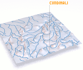 Places with similar names to Cundimali, Mozambique ::
// Kandamal (PH)
// Kent Mill (US)
// Candemil (PT)
// Candemil (PT)
// Contumil (PT)
// Gontomil (PT)
// Candamil (ES)
// Candemuela (ES)
// Quindimil (ES)
// Kennedy Mill (US)
Disclaimer :: Information on this page comes without warranty of any kind |
||
|
Where is Cundimali? Elevation and coordinates ::
Latitude (lat): 12°54'52"S Longitude (lon): 35°32'12"E
Elevation (approx.): 996m (map arrows pan, magnifying glasses zoom) |
||
|
Visiting Cundimali? Hotel/Accommodation ::
Book a hotel in Cundimali Travel Guide ::
Buy a travel guide for Mozambique rental cars ::
car rental offers GPS waypoint ::
download a GPX waypoint (PoI) of Cundimali for your GPS receiver
|
||