|
search place name
|
||
C. Zava (Gaza, Mozambique)C. Zava is a town in the Gaza region of Mozambique. An overview map of the region around C. Zava is displayed below.
regional and 3d topo map of C. Zava, Mozambique ::

C. Zava airports ::
The nearest airport is MPM - Maputo, located 124.1 km south west of C. Zava.
Other airports nearby include SZK - Skukuza (176.3 km west), Nearby towns ::
R. Muzui (3.4km north west) //
C. Mainguelane (3.9km north east) //
C. Gutsuine (4.4km south) //
Aldeia Mabauane (4.2km east) //
Majegane (5.0km south) //
Tchovane (6.1km north) //
Mango (6.1km north) //
Mainguelane (6.1km north east) //
C. Chelpa (6.6km south west) //
Tlacula (7.4km east) //
Muzondi (8.2km north) //
Laudine (7.7km west) //
Chefe Mapaje (8.6km north) //
Chefe Pinhane (8.4km north east) //
Mebango (8.6km north east) //
Sconela (9.1km north west) //
C. Malamba (9.1km south west) //
Chefe Mucoque (10.0km north west) //
Chefe Machalucuane (10.3km north east) //
Mucagane (10.3km south west) //
C. Chirrinzanine (10.6km south east) //
[all distances 'as the bird flies' and approximate] 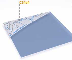 Places with similar names to C. Zava, Mozambique ::
Disclaimer :: Information on this page comes without warranty of any kind |
||
|
Where is C. Zava? Elevation and coordinates ::
Latitude (lat): 25°2'18"S Longitude (lon): 33°20'0"E
Elevation (approx.): 48m (map arrows pan, magnifying glasses zoom) |
||
|
Visiting C. Zava? Hotel/Accommodation ::
Book a hotel in C. Zava Travel Guide ::
Buy a travel guide for Mozambique rental cars ::
car rental offers GPS waypoint ::
download a GPX waypoint (PoI) of C. Zava for your GPS receiver
|
||