|
search place name
|
||
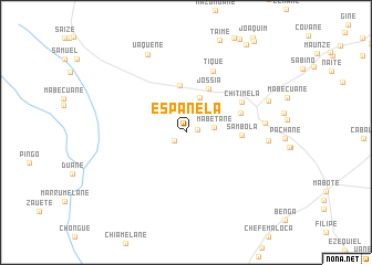
Espanela (Inhambane, Mozambique)Espanela is a town in the Inhambane region of Mozambique. An overview map of the region around Espanela is displayed below.
regional and 3d topo map of Espanela, Mozambique ::
Espanela airports ::
The nearest airport is VNX - Vilankulu Vilankulo, located 135.0 km east of Espanela.
Other airports nearby include INH - Inhambane (254.0 km south east), Nearby towns ::
Jeque (1.1km east) //
Macassa (1.4km south west) //
Mabetane (2.7km east) //
Samuel (3.7km north) //
Chicaene (4.8km north) //
Jossia (4.9km north east) //
Sambola (5.3km east) //
Saute (5.5km east) //
Chitimela (6.0km north east) //
Tique (6.6km north) //
Régulo Chichongue (7.5km east) //
Passane (7.8km east) //
Uaquene (8.6km north west) //
Muangalane (8.3km north east) //
Maganhane (10.5km north east) //
[all distances 'as the bird flies' and approximate] 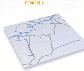 Places with similar names to Espanela, Mozambique ::
// Espanola (US)
// Espinal (CU)
// Espanillo (ES)
// Espiniella (ES)
// Espiniella (ES)
// Espinilla (ES)
// Espanola (US)
// Espanola (US)
// Espinal (CO)
// Espinal (CO)
Disclaimer :: Information on this page comes without warranty of any kind |
||
|
Where is Espanela? Elevation and coordinates ::
Latitude (lat): 21°59'10"S Longitude (lon): 34°0'23"E
Elevation (approx.): 175m (map arrows pan, magnifying glasses zoom) |
||
|
Visiting Espanela? Hotel/Accommodation ::
Book a hotel in Espanela Travel Guide ::
Buy a travel guide for Mozambique rental cars ::
car rental offers GPS waypoint ::
download a GPX waypoint (PoI) of Espanela for your GPS receiver
|
||