|
search place name
|
||
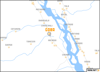
Goba (Sofala, Mozambique)Goba is a town in the Sofala region of Mozambique. An overview map of the region around Goba is displayed below.
regional and 3d topo map of Goba, Mozambique ::
Goba airports ::
The nearest airport is BLZ - Blantyre Chileka Intl, located 157.1 km north of Goba.
Other airports nearby include TET - Tete Chingodzi (168.5 km north west), Nearby towns ::
Macanga (2.6km south) //
Chivulivuli (3.2km north) //
Anjeje (3.9km south east) //
Lambani (4.1km south east) //
Nhamedola (5.3km north west) //
Tomeceni (7.5km south west) //
Tinente (7.5km east) //
Macruso (7.6km north east) //
Sonde (7.6km east) //
Sinjol (8.7km north east) //
Chemba (9.7km south east) //
Mérica (10.1km north east) //
[all distances 'as the bird flies' and approximate] 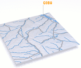 Places with similar names to Goba, Mozambique ::
Disclaimer :: Information on this page comes without warranty of any kind |
||
|
Where is Goba? Elevation and coordinates ::
Latitude (lat): 17°5'36"S Longitude (lon): 34°50'29"E
Elevation (approx.): 63m (map arrows pan, magnifying glasses zoom) |
||
|
Visiting Goba? Hotel/Accommodation ::
Book a hotel in Goba Travel Guide ::
Buy a travel guide for Mozambique rental cars ::
car rental offers GPS waypoint ::
download a GPX waypoint (PoI) of Goba for your GPS receiver
|
||