|
search place name
|
||
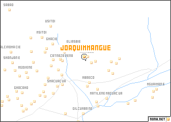
Joaquim Mangue (Inhambane, Mozambique)Joaquim Mangue is a town in the Inhambane region of Mozambique. An overview map of the region around Joaquim Mangue is displayed below.
regional and 3d topo map of Joaquim Mangue, Mozambique ::
Joaquim Mangue airports ::
The nearest airport is INH - Inhambane, located 136.2 km east of Joaquim Mangue.
Other airports nearby include MPM - Maputo (237.8 km south west), Nearby towns ::
M. Mangue (1.0km north east) //
M. Guambe (1.3km east) //
F. Matsombe (2.0km east) //
Elias Bie (3.9km north west) //
M. Baeco (4.8km south) //
U. Manzule (4.6km north west) //
Cat. Nazarena (4.6km west) //
Manuel (5.0km west) //
S. Matsombe (5.1km south east) //
Guemane Macuácua (5.5km south) //
Chefe Baxavano (5.1km east) //
Mau-é-ele (5.6km south west) //
Marão (5.8km west) //
Baxavane (6.1km south east) //
M. Touele (6.6km south) //
Valente Pumele (6.2km east) //
M. Cossa (6.5km west) //
Elias Guambe (7.0km south west) //
Elinga Macuácua (6.8km east) //
Mau-é-ele (7.0km west) //
G. Macie (7.6km north west) //
S. Macuácua (7.9km south west) //
M. Mubai (8.3km west) //
Joaquim Touele (8.4km south west) //
E. Mubai (8.3km west) //
Matilene Macuácua (9.3km south east) //
E. Matsombe (9.7km south west) //
U. Sitoi (10.4km north west) //
Cat. Metodista (11.2km south west) //
[all distances 'as the bird flies' and approximate] 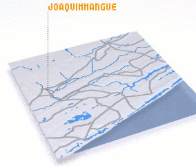 Places with similar names to Joaquim Mangue, Mozambique :: Disclaimer :: Information on this page comes without warranty of any kind |
||
|
Where is Joaquim Mangue? Elevation and coordinates ::
Latitude (lat): 24°20'25"S Longitude (lon): 34°10'4"E
Elevation (approx.): 57m (map arrows pan, magnifying glasses zoom) |
||
|
Visiting Joaquim Mangue? Hotel/Accommodation ::
Book a hotel in Joaquim Mangue Travel Guide ::
Buy a travel guide for Mozambique rental cars ::
car rental offers GPS waypoint ::
download a GPX waypoint (PoI) of Joaquim Mangue for your GPS receiver
|
||