|
search place name
|
||
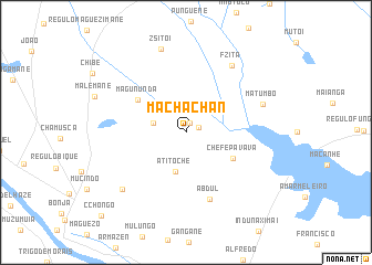
Machachan (Gaza, Mozambique)Machachan is a town in the Gaza region of Mozambique. An overview map of the region around Machachan is displayed below.
regional and 3d topo map of Machachan, Mozambique ::
Machachan airports ::
The nearest airport is SZK - Skukuza, located 167.6 km west of Machachan.
Other airports nearby include MPM - Maputo (176.7 km south), PHW - Phalaborwa (207.4 km west), Nearby towns ::
Tuquai (1.0km north) //
Dezindezine (1.3km north east) //
F. Chambane (3.2km west) //
A. Titoche (4.1km south) //
Chefe Pavava (5.0km south east) //
Magununda (5.5km north west) //
Abdul (7.1km south) //
Matumbo (7.6km east) //
F. Zita (8.0km north east) //
Chicuacua (8.2km south west) //
Z. Sitói (8.8km north) //
C. Chongo (11.5km south west) //
[all distances 'as the bird flies' and approximate] 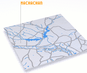 Places with similar names to Machachan, Mozambique ::
// Moshchana (UA)
// Moshchany (UA)
// Moshchëna (UA)
// Moshchnyy (UA)
// Mashashane (ZA)
// Moshchëna (RU)
// Moshchëny (RU)
// Moshchiny (RU)
// Moshichino (RU)
// Mshichino (RU)
Disclaimer :: Information on this page comes without warranty of any kind |
||
|
Where is Machachan? Elevation and coordinates ::
Latitude (lat): 24°24'30"S Longitude (lon): 33°7'49"E
Elevation (approx.): 27m (map arrows pan, magnifying glasses zoom) |
||
|
Visiting Machachan? Hotel/Accommodation ::
Book a hotel in Machachan Travel Guide ::
Buy a travel guide for Mozambique rental cars ::
car rental offers GPS waypoint ::
download a GPX waypoint (PoI) of Machachan for your GPS receiver
|
||