|
search place name
|
||
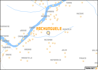
Machunguele (Inhambane, Mozambique)Machunguele is a town in the Inhambane region of Mozambique. An overview map of the region around Machunguele is displayed below.
regional and 3d topo map of Machunguele, Mozambique ::
Machunguele airports ::
The nearest airport is VNX - Vilankulu Vilankulo, located 122.7 km south east of Machunguele.
Other airports nearby include BEW - Beira (170.6 km north), Nearby towns ::
Meque (0.7km north) //
Nezomba (2.9km south) //
Quepane (3.0km west) //
Caetano (3.4km south east) //
Facetela (3.8km south east) //
Jamo (4.3km south) //
Manuel (4.3km north west) //
Gonhamo (4.5km north) //
Mapanane (4.6km west) //
Fulau (5.4km south) //
Julai (5.4km north west) //
Mafande (5.4km west) //
Checongane (5.7km north west) //
Faria (6.0km north) //
Bande (5.6km west) //
Zaquene (5.7km west) //
Massaite (6.2km north) //
Chigoela (5.9km east) //
Cheavane (6.4km north east) //
Ferrengue (6.1km west) //
Finiasse (6.6km south) //
Chumbane (6.4km west) //
Chuva (6.9km north) //
Chevanze (6.9km north east) //
Magaizane (6.5km west) //
Penicela (6.7km east) //
Finiasse (7.4km north) //
Machotane (7.1km west) //
Mandava (7.3km west) //
[all distances 'as the bird flies' and approximate]  Places with similar names to Machunguele, Mozambique ::
// Mashown Kolā (IR)
// Machanguele (MZ)
// Machangulo (MZ)
// Machenguela (MZ)
// Machinguel (MZ)
// Machunguele (MZ)
// Machunguele (MZ)
// Mechincula (MZ)
// Mich'on-gol (KP)
// Muchain Kili (PK)
Disclaimer :: Information on this page comes without warranty of any kind |
||
|
Where is Machunguele? Elevation and coordinates ::
Latitude (lat): 21°16'20"S Longitude (lon): 34°26'14"E
Elevation (approx.): 59m (map arrows pan, magnifying glasses zoom) |
||
|
Visiting Machunguele? Hotel/Accommodation ::
Book a hotel in Machunguele Travel Guide ::
Buy a travel guide for Mozambique rental cars ::
car rental offers GPS waypoint ::
download a GPX waypoint (PoI) of Machunguele for your GPS receiver
|
||