|
search place name
|
||
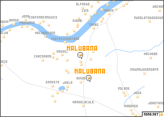
Malubana (Inhambane, Mozambique)Malubana is a town in the Inhambane region of Mozambique. An overview map of the region around Malubana is displayed below.
regional and 3d topo map of Malubana, Mozambique ::
Malubana airports ::
The nearest airport is VNX - Vilankulu Vilankulo, located 109.7 km south east of Malubana.
Other airports nearby include BEW - Beira (152.2 km north), Nearby towns ::
Tiane (0.8km south) //
Mahungo (1.5km south) //
Chivanzuane (1.9km east) //
Souquisse (2.6km south) //
Chefe Maluvane (2.8km south west) //
Baniana (2.9km north east) //
Chidácua (3.1km west) //
Malomolele (4.1km north west) //
Chichongue (4.3km south west) //
Wilson (4.4km south west) //
Mausse (4.2km west) //
Chefe Chindotana (5.1km north west) //
Avida (5.5km south) //
Malubana (5.5km south) //
Induna (5.3km west) //
Massoja (6.4km north west) //
Bango (6.5km north) //
Macassa (6.1km west) //
Bacequete (6.2km west) //
Joela (7.1km south west) //
João (7.3km north) //
Tambo (7.3km north) //
Siambi (7.8km north) //
Silva (7.9km south west) //
Chambanhuco (8.6km south west) //
Marques (9.0km north) //
Ernesto (8.9km south west) //
Mucale (9.5km north east) //
Chichande (9.5km south west) //
[all distances 'as the bird flies' and approximate] 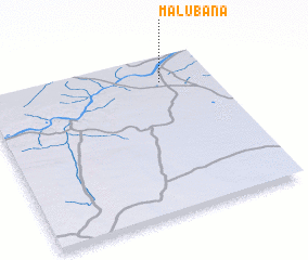 Places with similar names to Malubana, Mozambique ::
Disclaimer :: Information on this page comes without warranty of any kind |
||
|
Where is Malubana? Elevation and coordinates ::
Latitude (lat): 21°9'56"S Longitude (lon): 34°46'24"E
Elevation (approx.): 47m (map arrows pan, magnifying glasses zoom) |
||
|
Visiting Malubana? Hotel/Accommodation ::
Book a hotel in Malubana Travel Guide ::
Buy a travel guide for Mozambique rental cars ::
car rental offers GPS waypoint ::
download a GPX waypoint (PoI) of Malubana for your GPS receiver
|
||