|
search place name
|
||
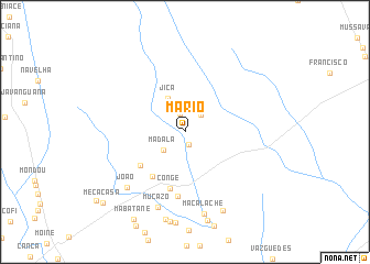
Mário (Maputo, Mozambique)Mário is a town in the Maputo region of Mozambique. An overview map of the region around Mário is displayed below.
regional and 3d topo map of Mário, Mozambique ::
Mário airports ::
The nearest airport is SZK - Skukuza, located 109.8 km west of Mário.
Other airports nearby include MPM - Maputo (126.1 km south), HDS - Hoedspruit Afb (169.4 km west), PHW - Phalaborwa (179.1 km north west), MTS - Manzini Matsapha (236.0 km south west), Nearby towns ::
Machele (1.4km south) //
Massanarro (1.9km north) //
Chissuana (2.3km north east) //
Madala (2.7km south west) //
Jica (3.7km north west) //
Valone (5.4km south west) //
Chicanequice (5.4km south west) //
Conge (5.9km south) //
Sabão (6.5km south) //
Mucazo (8.0km south) //
João (7.7km south west) //
Macalache (8.5km south) //
Guenhana (8.7km south east) //
Cio (9.1km south) //
Mecacasa (10.4km south west) //
[all distances 'as the bird flies' and approximate]  Places with similar names to Mário, Mozambique ::
Disclaimer :: Information on this page comes without warranty of any kind |
||
|
Where is Mário? Elevation and coordinates ::
Latitude (lat): 24°47'8"S Longitude (lon): 32°39'28"E
Elevation (approx.): 54m (map arrows pan, magnifying glasses zoom) |
||
|
Visiting Mário? Hotel/Accommodation ::
Book a hotel in Mário Travel Guide ::
Buy a travel guide for Mozambique rental cars ::
car rental offers GPS waypoint ::
download a GPX waypoint (PoI) of Mário for your GPS receiver
|
||