|
search place name
|
||
Marromeu (Sofala, Mozambique)Marromeu is a town in the Sofala region of Mozambique. An overview map of the region around Marromeu is displayed below.
regional and 3d topo map of Marromeu, Mozambique ::

Marromeu airports ::
The nearest airport is UEL - Quelimane, located 109.0 km north east of Marromeu.
Other airports nearby include BEW - Beira (199.3 km south west), Nearby towns ::
Caçador (1.0km east) //
Jonh Porão (3.0km east) //
Alfaiate (3.1km west) //
João (3.1km west) //
Tomaz (3.5km north east) //
Inhagombe (3.5km north east) //
Nhampoca (4.1km east) //
João (4.1km east) //
Inquini (5.9km north west) //
Pinho (6.2km west) //
Comissale (6.7km south) //
Luís (6.6km west) //
Nhane (7.1km west) //
Camba (8.2km west) //
Pesseoa (8.4km north east) //
Pesseca (8.4km north east) //
João (8.7km west) //
Jequessene (9.5km north west) //
Tomedembe (10.5km north west) //
[all distances 'as the bird flies' and approximate] 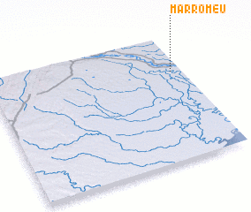 Places with similar names to Marromeu, Mozambique ::
Disclaimer :: Information on this page comes without warranty of any kind |
||
|
Where is Marromeu? Elevation and coordinates ::
Latitude (lat): 18°17'27"S Longitude (lon): 35°56'43"E
Elevation (approx.): 13m (map arrows pan, magnifying glasses zoom) |
||
|
Visiting Marromeu? Hotel/Accommodation ::
Book a hotel in Marromeu Travel Guide ::
Buy a travel guide for Mozambique rental cars ::
car rental offers GPS waypoint ::
download a GPX waypoint (PoI) of Marromeu for your GPS receiver
|
||