|
search place name
|
||
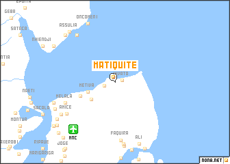
Matiquite (Nampula, Mozambique)Matiquite is a town in the Nampula region of Mozambique. An overview map of the region around Matiquite is displayed below.
regional and 3d topo map of Matiquite, Mozambique ::
Matiquite airports ::
The nearest airport is MNC - Nacala, located 10.1 km south west of Matiquite.
Other airports nearby include POL - Pemba (160.7 km north), APL - Nampula (177.6 km south west), Nearby towns ::
Xivato (1.2km east) //
Maxilone (1.8km west) //
Metiva (4.5km west) //
Amade (4.6km south west) //
Marazarazi (5.9km west) //
Namaculula (8.6km south west) //
Melala (8.6km south west) //
Amice (9.3km south west) //
Xapala (9.8km north west) //
Maiaia (10.0km south west) //
Assulia (10.8km north west) //
Murire (11.0km north west) //
[all distances 'as the bird flies' and approximate] 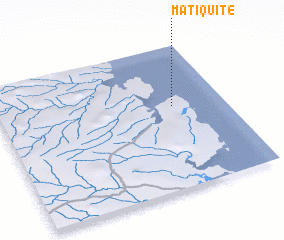 Places with similar names to Matiquite, Mozambique ::
// Meadowgate (US)
// Mitakáta (GR)
// Maytiguid (PH)
// Madaket (US)
// Meadow Gate (US)
// Mādkāti (BD)
// Mātikāta (BD)
// Mātikāta (BD)
// Mātikāta (BD)
// Mātikāta (BD)
Disclaimer :: Information on this page comes without warranty of any kind |
||
|
Where is Matiquite? Elevation and coordinates ::
Latitude (lat): 14°25'8"S Longitude (lon): 40°46'22"E
Elevation (approx.): 10m (map arrows pan, magnifying glasses zoom) |
||
|
Visiting Matiquite? Hotel/Accommodation ::
Book a hotel in Matiquite Travel Guide ::
Buy a travel guide for Mozambique rental cars ::
car rental offers GPS waypoint ::
download a GPX waypoint (PoI) of Matiquite for your GPS receiver
|
||