|
search place name
|
||
Mavevere (Mozambique)Mavevere is a town in Mozambique. An overview map of the region around Mavevere is displayed below.
regional and 3d topo map of Mavevere, Mozambique ::

Mavevere airports ::
The nearest airport is SZK - Skukuza, located 141.2 km south west of Mavevere.
Other airports nearby include MPM - Maputo (165.6 km south), PHW - Phalaborwa (182.9 km west), HDS - Hoedspruit Afb (184.6 km west), Nearby towns ::
Massohoro (1.9km north) //
Aldeia Comunais Manjangue (2.6km north west) //
Manjangue (2.9km north west) //
Mahuho (4.3km north east) //
Barragem (4.7km north) //
Justino (5.0km north west) //
Chirunzo (4.9km east) //
Chirrunduo (5.2km north east) //
Matuba (5.8km south east) //
Macarretane (6.2km north) //
Chinhacanine (6.0km north east) //
Matuba (6.1km east) //
Massecane (6.1km east) //
Aldeia Comunais Matuba (6.6km south east) //
Macarretane (8.0km north) //
Chau-Chau (7.6km north west) //
Mambecheco (7.4km west) //
Chate (8.1km north west) //
Aldeia Comunais Mubanguer (8.4km north east) //
João (8.8km north east) //
Gelene (9.7km north west) //
[all distances 'as the bird flies' and approximate] 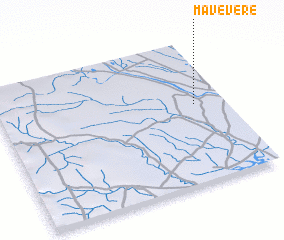 Places with similar names to Mavevere, Mozambique ::
// Mafufure (SL)
Disclaimer :: Information on this page comes without warranty of any kind |
||
|
Where is Mavevere? Elevation and coordinates ::
Latitude (lat): 24°27'0"S Longitude (lon): 32°52'0"E
Elevation (approx.): 38m (map arrows pan, magnifying glasses zoom) |
||
|
Visiting Mavevere? Hotel/Accommodation ::
Book a hotel in Mavevere Travel Guide ::
Buy a travel guide for Mozambique rental cars ::
car rental offers GPS waypoint ::
download a GPX waypoint (PoI) of Mavevere for your GPS receiver
|
||