|
search place name
|
||
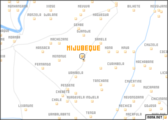
Mijubeque (Maputo, Mozambique)Mijubeque is a town in the Maputo region of Mozambique. An overview map of the region around Mijubeque is displayed below.
regional and 3d topo map of Mijubeque, Mozambique ::
Mijubeque airports ::
The nearest airport is MPM - Maputo, located 37.1 km south east of Mijubeque.
Other airports nearby include SZK - Skukuza (109.3 km north west), MTS - Manzini Matsapha (146.4 km south west), HDS - Hoedspruit Afb (194.4 km north west), PHW - Phalaborwa (225.2 km north west), Nearby towns ::
Mahimbela (0.0km north) //
Uamibela (4.1km south west) //
Chiconela (3.8km south east) //
Chai-Chai (5.0km north east) //
Samele (5.0km north east) //
Menonde (5.0km west) //
Djandje (5.6km north) //
Joaquim (5.3km east) //
Mona (5.3km east) //
Machezane (6.2km north west) //
Tanchane (6.5km south east) //
Gembe (7.1km north) //
C. Uaimbela (6.7km east) //
Pessene (7.3km south west) //
Muanjotela (7.6km south) //
Joaquim (6.9km east) //
Maxovane (7.5km south east) //
Chibone (7.6km north west) //
Chebete (9.1km south west) //
[all distances 'as the bird flies' and approximate] 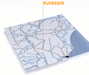
Disclaimer :: Information on this page comes without warranty of any kind |
||
|
Where is Mijubeque? Elevation and coordinates ::
Latitude (lat): 25°38'0"S Longitude (lon): 32°23'0"E
Elevation (approx.): 107m (map arrows pan, magnifying glasses zoom) |
||
|
Visiting Mijubeque? Hotel/Accommodation ::
Book a hotel in Mijubeque Travel Guide ::
Buy a travel guide for Mozambique rental cars ::
car rental offers GPS waypoint ::
download a GPX waypoint (PoI) of Mijubeque for your GPS receiver
|
||