|
search place name
|
||
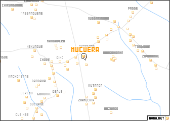
Mucuera (Sofala, Mozambique)Mucuera is a town in the Sofala region of Mozambique. An overview map of the region around Mucuera is displayed below.
regional and 3d topo map of Mucuera, Mozambique ::
Mucuera airports ::
The nearest airport is BEW - Beira, located 116.4 km north east of Mucuera.
Other airports nearby include VNX - Vilankulu Vilankulo (227.9 km south east), Nearby towns ::
Chuquela (0.8km north) //
Mexeme (1.0km south) //
Mapingue (1.7km west) //
Matoere (2.1km west) //
Nhabende (2.3km north) //
Chalombe (3.6km west) //
Gupargua (4.1km south west) //
Penicela (4.2km west) //
Dovanhama (5.0km north east) //
Gimo (5.2km west) //
Senetisse (5.7km north east) //
Chicuite (5.5km east) //
Golegã (5.8km north west) //
Mangomonhe (5.8km east) //
Mangomonhe (5.9km east) //
Cajananhe (6.2km east) //
Moio Achena (6.4km north west) //
Mada (6.6km north east) //
Mutanda (6.8km south) //
Mandavera (6.9km north west) //
Joaquim (6.9km west) //
Doenhe (6.9km west) //
Machala (7.2km north east) //
Juga (7.1km south west) //
Nova Golegã (7.1km west) //
Gomate (7.6km south) //
Nhabuto (8.1km south) //
Matusse (7.9km south west) //
Mexungué Velho (8.2km south west) //
[all distances 'as the bird flies' and approximate] 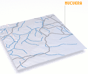 Places with similar names to Mucuera, Mozambique ::
Disclaimer :: Information on this page comes without warranty of any kind |
||
|
Where is Mucuera? Elevation and coordinates ::
Latitude (lat): 20°22'52"S Longitude (lon): 33°58'58"E
Elevation (approx.): 193m (map arrows pan, magnifying glasses zoom) |
||
|
Visiting Mucuera? Hotel/Accommodation ::
Book a hotel in Mucuera Travel Guide ::
Buy a travel guide for Mozambique rental cars ::
car rental offers GPS waypoint ::
download a GPX waypoint (PoI) of Mucuera for your GPS receiver
|
||