|
search place name
|
||
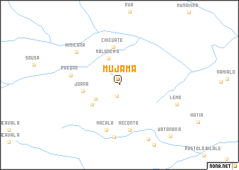
Mujama (Nampula, Mozambique)Mujama is a town in the Nampula region of Mozambique. An overview map of the region around Mujama is displayed below.
regional and 3d topo map of Mujama, Mozambique ::
Mujama airports ::
The nearest airport is APL - Nampula, located 62.3 km west of Mujama.
Other airports nearby include MNC - Nacala (106.6 km north east), POL - Pemba (227.4 km north), Nearby towns ::
Cuvea (1.7km south) //
João (2.3km north west) //
Pessene (4.2km south west) //
Malancha (4.5km north) //
Marreria (5.2km south west) //
Joana (5.7km west) //
Chicuate (6.1km north) //
Meconta (7.3km south) //
Macala (7.4km south) //
Rueque (7.5km west) //
Chacôpo (8.3km south) //
Minicana (8.3km north west) //
Mutapua (9.7km south east) //
Uatanana (11.1km south east) //
[all distances 'as the bird flies' and approximate] 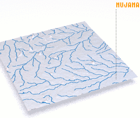 Places with similar names to Mujama, Mozambique ::
Disclaimer :: Information on this page comes without warranty of any kind |
||
|
Where is Mujama? Elevation and coordinates ::
Latitude (lat): 14°55'43"S Longitude (lon): 39°49'55"E
Elevation (approx.): 247m (map arrows pan, magnifying glasses zoom) |
||
|
Visiting Mujama? Hotel/Accommodation ::
Book a hotel in Mujama Travel Guide ::
Buy a travel guide for Mozambique rental cars ::
car rental offers GPS waypoint ::
download a GPX waypoint (PoI) of Mujama for your GPS receiver
|
||