|
search place name
|
||
Mulungo (Gaza, Mozambique)Mulungo is a town in the Gaza region of Mozambique. An overview map of the region around Mulungo is displayed below.
regional and 3d topo map of Mulungo, Mozambique ::

Mulungo airports ::
The nearest airport is SZK - Skukuza, located 160.2 km west of Mulungo.
Other airports nearby include MPM - Maputo (165.5 km south), PHW - Phalaborwa (206.3 km west), Nearby towns ::
Mapacha (2.4km east) //
Armazén (2.7km south west) //
Chefe Mussaiela (3.2km south) //
Sousuanine (3.3km south) //
Javela (4.2km south west) //
C. Chongo (4.3km north west) //
Gangane (4.3km east) //
Chicuacua (5.1km north) //
Régulo Chomane (5.4km south east) //
Maguezo (5.1km west) //
Régulo Muiachique (6.2km south east) //
Davide (6.5km south east) //
A. Titoche (7.2km north east) //
Mucindo (6.9km north west) //
Abdul (7.3km north east) //
Biluane (7.9km south) //
Matadouro (7.3km west) //
Bonja (7.8km west) //
Carreira de Tiro (8.0km north west) //
Vila Alferes Chamusca (7.8km west) //
Choponone (8.6km north west) //
Mulalene (8.8km south west) //
Gajane (9.4km south west) //
Javanhana (9.8km south east) //
Régulo Bique (10.4km north west) //
[all distances 'as the bird flies' and approximate] 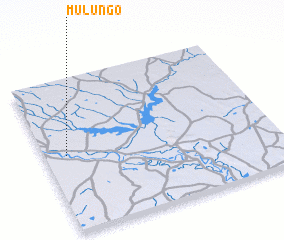 Places with similar names to Mulungo, Mozambique ::
Disclaimer :: Information on this page comes without warranty of any kind |
||
|
Where is Mulungo? Elevation and coordinates ::
Latitude (lat): 24°30'10"S Longitude (lon): 33°5'26"E
Elevation (approx.): 34m (map arrows pan, magnifying glasses zoom) |
||
|
Visiting Mulungo? Hotel/Accommodation ::
Book a hotel in Mulungo Travel Guide ::
Buy a travel guide for Mozambique rental cars ::
car rental offers GPS waypoint ::
download a GPX waypoint (PoI) of Mulungo for your GPS receiver
|
||