|
search place name
|
||
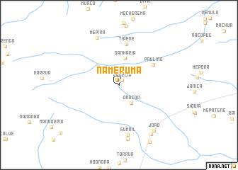
Nameruma (Nampula, Mozambique)Nameruma is a town in the Nampula region of Mozambique. An overview map of the region around Nameruma is displayed below.
regional and 3d topo map of Nameruma, Mozambique ::
Nameruma airports ::
The nearest airport is MNC - Nacala, located 48.2 km east of Nameruma.
Other airports nearby include APL - Nampula (120.4 km south west), POL - Pemba (184.5 km north), Nearby towns ::
Rauelia (0.9km north east) //
Opacar (3.4km south east) //
Ganharia (4.3km north) //
Paulino (6.1km north east) //
Tipene (6.5km north) //
Sumail (8.0km south) //
Mepira (8.2km north west) //
Novinte (8.6km south) //
João (8.9km south east) //
Anela (9.2km south east) //
[all distances 'as the bird flies' and approximate] 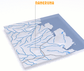 Places with similar names to Nameruma, Mozambique ::
Disclaimer :: Information on this page comes without warranty of any kind |
||
|
Where is Nameruma? Elevation and coordinates ::
Latitude (lat): 14°38'22"S Longitude (lon): 40°17'35"E
Elevation (approx.): 226m (map arrows pan, magnifying glasses zoom) |
||
|
Visiting Nameruma? Hotel/Accommodation ::
Book a hotel in Nameruma Travel Guide ::
Buy a travel guide for Mozambique rental cars ::
car rental offers GPS waypoint ::
download a GPX waypoint (PoI) of Nameruma for your GPS receiver
|
||