|
search place name
|
||
Nametil (Mozambique)Nametil is a town in Mozambique. An overview map of the region around Nametil is displayed below.
regional and 3d topo map of Nametil, Mozambique ::

Nametil airports ::
The nearest airport is MNC - Nacala, located 34.8 km south east of Nametil.
Other airports nearby include POL - Pemba (136.1 km north), APL - Nampula (168.3 km south west), Nearby towns ::
Ucaiba (0.0km north) //
Mecuta (0.0km north) //
Muze (0.6km south east) //
Puquine (0.7km south) //
Mazimingi (1.8km east) //
Nabuara (2.6km south east) //
Meconine (2.6km north west) //
Fernando (3.2km south) //
Otugo (3.6km east) //
Macorrene (4.0km south east) //
Mocorrene (4.0km south east) //
Mezela (4.1km north west) //
Naco (4.1km north west) //
Memba (4.7km north west) //
Papilo (4.8km west) //
Formone (5.0km east) //
Nantui (5.0km south east) //
Ilapu (5.2km south) //
Ecota (5.5km south east) //
Napura (5.7km south) //
Namecoio (6.1km south west) //
Luciano (6.5km west) //
Viage (6.6km south west) //
Maresane (6.9km south east) //
Mepata (7.3km north) //
Onamoro (7.4km north) //
Urrucuni (7.6km north) //
Onhanho (7.6km north) //
Moendaze (7.8km north) //
[all distances 'as the bird flies' and approximate] 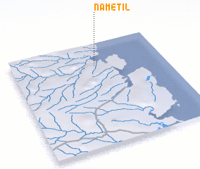 Places with similar names to Nametil, Mozambique ::
Disclaimer :: Information on this page comes without warranty of any kind |
||
|
Where is Nametil? Elevation and coordinates ::
Latitude (lat): 14°13'0"S Longitude (lon): 40°33'0"E
Elevation (approx.): 19m (map arrows pan, magnifying glasses zoom) |
||
|
Visiting Nametil? Hotel/Accommodation ::
Book a hotel in Nametil Travel Guide ::
Buy a travel guide for Mozambique rental cars ::
car rental offers GPS waypoint ::
download a GPX waypoint (PoI) of Nametil for your GPS receiver
|
||