|
search place name
|
||
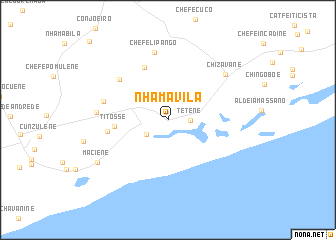
Nhamavila (Gaza, Mozambique)Nhamavila is a town in the Gaza region of Mozambique. An overview map of the region around Nhamavila is displayed below.
regional and 3d topo map of Nhamavila, Mozambique ::
Nhamavila airports ::
The nearest airport is MPM - Maputo, located 171.4 km south west of Nhamavila.
Other airports nearby include INH - Inhambane (193.8 km north east), Nearby towns ::
Tetene (2.3km east) //
Chefe Cumbene (2.7km south west) //
Titôsse (5.5km west) //
Chefe Chissanuine (6.3km north west) //
Chefe Gangolene (6.3km west) //
Chefe Nhapequene (6.7km north west) //
Chefe Nhatsembene (6.8km west) //
Chefe Lipango (7.7km north) //
Tomás (7.2km west) //
Chizavane (7.7km north east) //
Maciene (8.6km south west) //
Regedor Manhumane (11.8km north west) //
[all distances 'as the bird flies' and approximate]  Places with similar names to Nhamavila, Mozambique :: Disclaimer :: Information on this page comes without warranty of any kind |
||
|
Where is Nhamavila? Elevation and coordinates ::
Latitude (lat): 24°59'37"S Longitude (lon): 33°56'14"E
Elevation (approx.): 49m (map arrows pan, magnifying glasses zoom) |
||
|
Visiting Nhamavila? Hotel/Accommodation ::
Book a hotel in Nhamavila Travel Guide ::
Buy a travel guide for Mozambique rental cars ::
car rental offers GPS waypoint ::
download a GPX waypoint (PoI) of Nhamavila for your GPS receiver
|
||