|
search place name
|
||
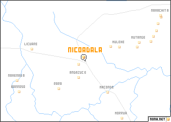
Nicoadala (Zambézia, Mozambique)Nicoadala is a town in the Zambézia region of Mozambique. An overview map of the region around Nicoadala is displayed below.
regional and 3d topo map of Nicoadala, Mozambique ::
Nicoadala airports ::
The nearest airport is UEL - Quelimane, located 27.9 km south of Nicoadala.
Other airports nearby include BLZ - Blantyre Chileka Intl (290.4 km north west), Nearby towns ::
 Places with similar names to Nicoadala, Mozambique ::
// Nağdalı (AZ)
// Nağdalı (AZ)
// Néa Kotýli (GR)
// Néa Koútali (GR)
// Ngadla (ZA)
// Ngadla (ZA)
// Nakitl' (RU)
// Nakitl' (RU)
// Nagtala (IN)
// Ngudul (ID)
Disclaimer :: Information on this page comes without warranty of any kind |
||
|
Where is Nicoadala? Elevation and coordinates ::
Latitude (lat): 17°36'29"S Longitude (lon): 36°49'11"E
Elevation (approx.): 15m (map arrows pan, magnifying glasses zoom) |
||
|
Visiting Nicoadala? Hotel/Accommodation ::
Book a hotel in Nicoadala Travel Guide ::
Buy a travel guide for Mozambique rental cars ::
car rental offers GPS waypoint ::
download a GPX waypoint (PoI) of Nicoadala for your GPS receiver
|
||