|
search place name
|
||
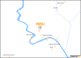
Pandi (Gaza, Mozambique)Pandi is a town in the Gaza region of Mozambique. An overview map of the region around Pandi is displayed below.
regional and 3d topo map of Pandi, Mozambique ::
Pandi airports ::
The nearest airport is BFO - Chiredzi Buffalo Range, located 142.7 km north of Pandi.
Other airports nearby include PHW - Phalaborwa (185.0 km south), LTA - Tzaneen (206.5 km south west), PTG - Pietersburg (272.9 km south west), Nearby towns ::
Muzamane (0.9km west) //
Assane (1.1km south west) //
Manjonjo (1.2km north) //
Maquecete (2.5km south) //
Chefe Chale (3.9km south) //
Mussamane (5.0km south east) //
Julai (5.6km south east) //
Mucajane (5.5km south west) //
Muamefichane (6.2km south west) //
Majemane (7.2km south west) //
Ulissone (8.1km south east) //
Chefe Manguana (8.3km south east) //
Chefe Bocoda (10.1km south east) //
Xaixe (10.9km north east) //
[all distances 'as the bird flies' and approximate]  Places with similar names to Pandi, Mozambique ::
Disclaimer :: Information on this page comes without warranty of any kind |
||
|
Where is Pandi? Elevation and coordinates ::
Latitude (lat): 22°17'38"S Longitude (lon): 31°28'51"E
Elevation (approx.): 223m (map arrows pan, magnifying glasses zoom) |
||
|
Visiting Pandi? Hotel/Accommodation ::
Book a hotel in Pandi Travel Guide ::
Buy a travel guide for Mozambique rental cars ::
car rental offers GPS waypoint ::
download a GPX waypoint (PoI) of Pandi for your GPS receiver
|
||