|
search place name
|
||
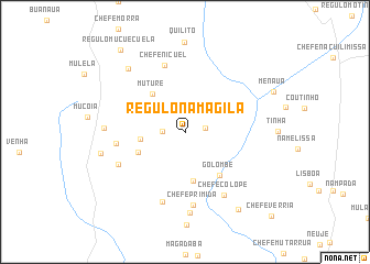
Régulo Namagila (Zambézia, Mozambique)Régulo Namagila is a town in the Zambézia region of Mozambique. An overview map of the region around Régulo Namagila is displayed below.
regional and 3d topo map of Régulo Namagila, Mozambique ::
Régulo Namagila airports ::
The nearest airport is UEL - Quelimane, located 164.7 km south of Régulo Namagila.
Nearby towns ::
Chefe Vitua (2.0km east) //
Namagila (2.2km west) //
Chefe Napato (2.7km north) //
Chefe Novara (4.4km west) //
Muture (5.0km north west) //
Chefe Namuaua (5.0km south) //
Régulo Maconde (5.0km south west) //
Golombe (5.6km south east) //
Chefe Nicuel (7.0km north) //
Mutagia (6.8km west) //
Chefe Papadela (7.4km south) //
Chefe Primida (7.5km south) //
Chefe Netala (7.3km south west) //
Chefe Colope (7.5km south east) //
Meriva (7.8km west) //
Mabua (8.2km south) //
Chefe Mucoia (8.5km north west) //
Mudirra (8.5km west) //
Chefe Intinha (9.4km south east) //
Régulo Mucuecuela (10.4km north west) //
Chefe Verria (12.0km south east) //
[all distances 'as the bird flies' and approximate] 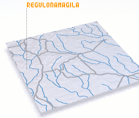 Places with similar names to Régulo Namagila, Mozambique :: Disclaimer :: Information on this page comes without warranty of any kind |
||
|
Where is Régulo Namagila? Elevation and coordinates ::
Latitude (lat): 16°22'50"S Longitude (lon): 37°4'37"E
Elevation (approx.): 330m (map arrows pan, magnifying glasses zoom) |
||
|
Visiting Régulo Namagila? Hotel/Accommodation ::
Book a hotel in Régulo Namagila Travel Guide ::
Buy a travel guide for Mozambique rental cars ::
car rental offers GPS waypoint ::
download a GPX waypoint (PoI) of Régulo Namagila for your GPS receiver
|
||