|
search place name
|
||
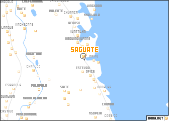
Saguate (Inhambane, Mozambique)Saguate is a town in the Inhambane region of Mozambique. An overview map of the region around Saguate is displayed below.
regional and 3d topo map of Saguate, Mozambique ::
Saguate airports ::
The nearest airport is VNX - Vilankulu Vilankulo, located 27.4 km south of Saguate.
Other airports nearby include BEW - Beira (222.3 km north), Nearby towns ::
Caulino (1.4km north) //
Naine (1.9km east) //
Estevão (2.5km south) //
Chuambo (2.8km east) //
Francisco (3.1km north) //
Sózinho Blande (3.5km north) //
Ofice (3.5km south) //
Meguião Mupane (4.2km north) //
Chepongo (4.6km south east) //
José Pene (5.2km south east) //
Murtalha (5.7km north) //
Semende (6.4km south) //
Chefe Macunhe (6.6km south) //
Afonso (7.8km north) //
Sòzinho (7.8km south west) //
Bobacar (7.9km south east) //
Saite (7.9km south west) //
Macume (8.1km south east) //
Ind. V. Uacheze (8.5km south west) //
Filipe (9.3km south west) //
[all distances 'as the bird flies' and approximate] 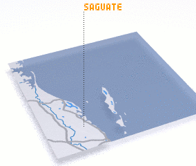 Places with similar names to Saguate, Mozambique ::
Disclaimer :: Information on this page comes without warranty of any kind |
||
|
Where is Saguate? Elevation and coordinates ::
Latitude (lat): 21°46'40"S Longitude (lon): 35°15'4"E
Elevation (approx.): 47m (map arrows pan, magnifying glasses zoom) |
||
|
Visiting Saguate? Hotel/Accommodation ::
Book a hotel in Saguate Travel Guide ::
Buy a travel guide for Mozambique rental cars ::
car rental offers GPS waypoint ::
download a GPX waypoint (PoI) of Saguate for your GPS receiver
|
||