|
search place name
|
||
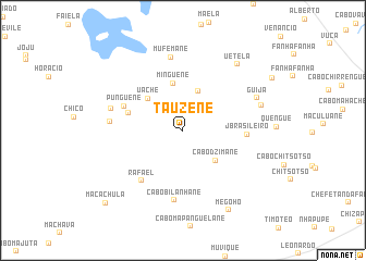
Tauzene (Inhambane, Mozambique)Tauzene is a town in the Inhambane region of Mozambique. An overview map of the region around Tauzene is displayed below.
regional and 3d topo map of Tauzene, Mozambique ::
Tauzene airports ::
The nearest airport is INH - Inhambane, located 53.8 km east of Tauzene.
Other airports nearby include VNX - Vilankulu Vilankulo (209.8 km north), Nearby towns ::
Cabo Inhaulane (4.3km north) //
Cabo Dzimane (4.4km south east) //
Uache (4.6km north west) //
Minguene (4.9km north) //
Maxavela (5.4km west) //
Punguene (6.1km north west) //
J. Brasileiro (6.0km east) //
Rafael (6.5km south west) //
Cabo Bilanhane (7.2km south) //
Macachula (6.9km west) //
Mufemane (7.6km north) //
Urrene (7.1km west) //
Guija (7.7km north east) //
Lago Tchine (7.8km east) //
Uetela (8.4km north east) //
Megoho (9.2km south east) //
Macachula (10.4km south west) //
[all distances 'as the bird flies' and approximate] 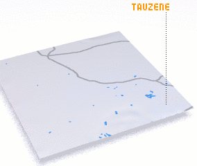 Places with similar names to Tauzene, Mozambique ::
Disclaimer :: Information on this page comes without warranty of any kind |
||
|
Where is Tauzene? Elevation and coordinates ::
Latitude (lat): 23°52'12"S Longitude (lon): 34°52'50"E
Elevation (approx.): 122m (map arrows pan, magnifying glasses zoom) |
||
|
Visiting Tauzene? Hotel/Accommodation ::
Book a hotel in Tauzene Travel Guide ::
Buy a travel guide for Mozambique rental cars ::
car rental offers GPS waypoint ::
download a GPX waypoint (PoI) of Tauzene for your GPS receiver
|
||