|
search place name
|
||
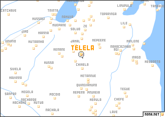
Télelà (Nampula, Mozambique)Télelà is a town in the Nampula region of Mozambique. An overview map of the region around Télelà is displayed below.
regional and 3d topo map of Télelà, Mozambique ::
Télelà airports ::
The nearest airport is MNC - Nacala, located 17.6 km north of Télelà.
Other airports nearby include APL - Nampula (159.0 km west), POL - Pemba (184.2 km north), Nearby towns ::
Paiva (1.2km north west) //
Muxilipo (1.4km north) //
Nauaua (1.7km south west) //
Chimela (2.3km south) //
Mechelipo (2.4km north west) //
Malaca (2.5km north west) //
Jamal (3.4km north west) //
Pranio (4.5km north) //
Muapo (4.5km west) //
Mapaguira (4.6km north east) //
Mepéere (4.9km north east) //
Metarrué (5.0km south) //
Menare (5.3km west) //
Macheude (5.5km south) //
Amade (5.7km north) //
Solu-o (6.1km north) //
Zé (6.5km north) //
Muarrica (6.8km south) //
Quirevamuro (7.1km south) //
Salimo (7.2km west) //
Agi (7.5km east) //
Mussa (7.6km west) //
Ussene (7.9km north) //
Cabeceira (8.2km north) //
Ussene (8.0km east) //
Conampia (8.5km north west) //
Muepane (8.5km north west) //
Taúdo (8.6km north) //
Mepera (8.7km south) //
[all distances 'as the bird flies' and approximate] 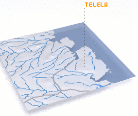 Places with similar names to Télelà, Mozambique ::
Disclaimer :: Information on this page comes without warranty of any kind |
||
|
Where is Télelà? Elevation and coordinates ::
Latitude (lat): 14°38'39"S Longitude (lon): 40°40'51"E
Elevation (approx.): 183m (map arrows pan, magnifying glasses zoom) |
||
|
Visiting Télelà? Hotel/Accommodation ::
Book a hotel in Télelà Travel Guide ::
Buy a travel guide for Mozambique rental cars ::
car rental offers GPS waypoint ::
download a GPX waypoint (PoI) of Télelà for your GPS receiver
|
||