|
search place name
|
||
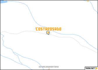
Costa Rosado (Ñeembucú, Paraguay)Costa Rosado is a town in the Ñeembucú region of Paraguay. An overview map of the region around Costa Rosado is displayed below.
regional and 3d topo map of Costa Rosado, Paraguay ::
Costa Rosado airports ::
The nearest airport is FMA - Formosa, located 59.1 km north west of Costa Rosado.
Other airports nearby include CNQ - Corrientes (120.3 km south west), RES - Resistencia (142.5 km south west), ASU - Asuncion Silvio Pettirossi Intl (163.0 km north), PSS - Posadas (208.9 km south east), Nearby towns ::
San Juan Neembucú (2.5km north west) //
[all distances 'as the bird flies' and approximate] 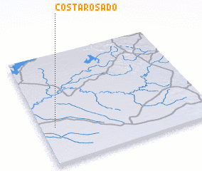 Places with similar names to Costa Rosado, Paraguay ::
// Castro City (US)
// Gozhdarazhdë (AL)
// Custer City (US)
// Custer City (US)
// Custer City (US)
// Costeraste (FR)
Disclaimer :: Information on this page comes without warranty of any kind |
||
|
Where is Costa Rosado? Elevation and coordinates ::
Latitude (lat): 26°40'0"S Longitude (lon): 57°55'0"W
Elevation (approx.): 63m (map arrows pan, magnifying glasses zoom) |
||
|
Visiting Costa Rosado? Hotel/Accommodation ::
Book a hotel in Costa Rosado Travel Guide ::
Buy a travel guide for Paraguay rental cars ::
car rental offers GPS waypoint ::
download a GPX waypoint (PoI) of Costa Rosado for your GPS receiver
|
||