|
search place name
|
||
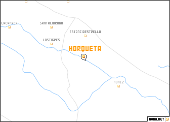
Horqueta (Presidente Hayes, Paraguay)Horqueta is a town in the Presidente Hayes region of Paraguay. An overview map of the region around Horqueta is displayed below.
regional and 3d topo map of Horqueta, Paraguay ::
Horqueta airports ::
The nearest airport is ASU - Asuncion Silvio Pettirossi Intl, located 87.3 km south east of Horqueta.
Other airports nearby include FMA - Formosa (145.6 km south), Nearby towns ::
Estancia Estrella (5.6km north) //
Los Tigres (7.7km north west) //
Núñez (8.7km south east) //
Santa Librada (10.0km north west) //
[all distances 'as the bird flies' and approximate] 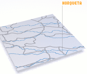 Places with similar names to Horqueta, Paraguay ::
Disclaimer :: Information on this page comes without warranty of any kind |
||
|
Where is Horqueta? Elevation and coordinates ::
Latitude (lat): 24°54'0"S Longitude (lon): 58°18'0"W
Elevation (approx.): 77m (map arrows pan, magnifying glasses zoom) |
||
|
Visiting Horqueta? Hotel/Accommodation ::
Book a hotel in Horqueta Travel Guide ::
Buy a travel guide for Paraguay rental cars ::
car rental offers GPS waypoint ::
download a GPX waypoint (PoI) of Horqueta for your GPS receiver
|
||