|
search place name
|
||
Getmata (Papua New Guinea)Getmata is a town in Papua New Guinea. An overview map of the region around Getmata is displayed below.
regional and 3d topo map of Getmata, Papua New Guinea ::
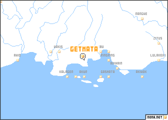
Nearby towns ::
Akur (3.7km south) //
Anato (4.1km south west) //
Zebu (4.1km north east) //
Kalagen (5.2km south west) //
Awirin (5.2km south east) //
Ringring (5.5km east) //
Amenpa (5.5km east) //
Sigilwa (5.8km east) //
Wakis (5.8km west) //
Gasmata (6.7km south east) //
Ngati (7.6km west) //
Ami (7.6km west) //
Akam (7.6km east) //
Avihain (7.6km east) //
[all distances 'as the bird flies' and approximate] 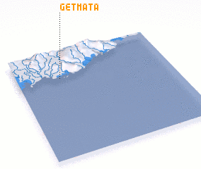 Places with similar names to Getmata, Papua New Guinea :: Disclaimer :: Information on this page comes without warranty of any kind |
||
|
Where is Getmata? Elevation and coordinates ::
Latitude (lat): 6°15'0"S Longitude (lon): 150°17'0"E
Elevation (approx.): 44m (map arrows pan, magnifying glasses zoom) |
||
|
Visiting Getmata? Hotel/Accommodation ::
Book a hotel in Getmata Travel Guide ::
rental cars ::
car rental offers GPS waypoint ::
download a GPX waypoint (PoI) of Getmata for your GPS receiver
|
||