|
search place name
|
||
Giwobi (Papua New Guinea)Giwobi is a town in Papua New Guinea. An overview map of the region around Giwobi is displayed below.
regional and 3d topo map of Giwobi, Papua New Guinea ::
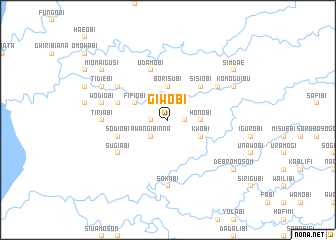
Nearby towns ::
Moiasubi (1.9km north) //
Waribinna (1.8km west) //
Uwaribinna (1.8km east) //
Awangibinna (2.6km south west) //
Borisubi (3.7km north) //
Honobi (3.7km east) //
Fifiobi (4.1km north west) //
Adu (4.1km north west) //
Kwobi (4.1km south east) //
Sisiobi (5.2km north east) //
Shuamosom (5.2km north east) //
Udamobi (5.9km north) //
Giporibi (5.8km west) //
Honinabi (5.8km west) //
Sodiobi (5.8km west) //
Andumosom (6.7km north east) //
Kioribi (6.7km north west) //
Sugiabi (6.7km south west) //
Tiriabi (7.4km west) //
Sokabi (7.4km south) //
Wodiobi (7.6km west) //
Tidiebi (8.2km north west) //
Komoguibu (8.2km north east) //
Miomaigusi (9.2km north west) //
Simdae (9.2km north east) //
Debromosom (9.2km south east) //
[all distances 'as the bird flies' and approximate] 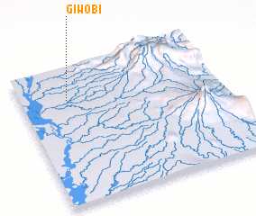 Places with similar names to Giwobi, Papua New Guinea ::
Disclaimer :: Information on this page comes without warranty of any kind |
||
|
Where is Giwobi? Elevation and coordinates ::
Latitude (lat): 6°14'0"S Longitude (lon): 142°14'0"E
Elevation (approx.): 143m (map arrows pan, magnifying glasses zoom) |
||
|
Visiting Giwobi? Hotel/Accommodation ::
Book a hotel in Giwobi Travel Guide ::
rental cars ::
car rental offers GPS waypoint ::
download a GPX waypoint (PoI) of Giwobi for your GPS receiver
|
||