|
search place name
|
||
Haulo (Papua New Guinea)Haulo is a town in Papua New Guinea. An overview map of the region around Haulo is displayed below.
regional and 3d topo map of Haulo, Papua New Guinea ::
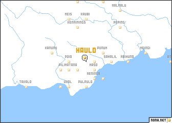
Nearby towns ::
Koratul (1.8km east) //
Leli (2.6km south west) //
Maso (2.6km south east) //
Poio (3.7km west) //
Pilimatana (4.1km south west) //
Meninga (4.1km south east) //
Punum (4.1km north east) //
Massua (5.2km south east) //
Raulili (5.5km east) //
Sahalil (5.5km east) //
Pulpulo (5.6km south) //
Lausis (5.8km west) //
Ruahana (6.7km south west) //
Uvol (6.7km south west) //
Kanunu (7.6km west) //
Kenminings (7.6km north) //
Inahele (7.8km south west) //
Meleton (7.8km south west) //
Peping (10.5km north east) //
[all distances 'as the bird flies' and approximate] 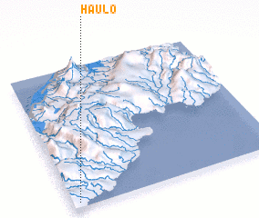 Places with similar names to Haulo, Papua New Guinea ::
Disclaimer :: Information on this page comes without warranty of any kind |
||
|
Where is Haulo? Elevation and coordinates ::
Latitude (lat): 5°58'0"S Longitude (lon): 151°2'0"E
Elevation (approx.): 213m (map arrows pan, magnifying glasses zoom) |
||
|
Visiting Haulo? Hotel/Accommodation ::
Book a hotel in Haulo Travel Guide ::
rental cars ::
car rental offers GPS waypoint ::
download a GPX waypoint (PoI) of Haulo for your GPS receiver
|
||