|
search place name
|
||
Hawapa (Papua New Guinea)Hawapa is a town in Papua New Guinea. An overview map of the region around Hawapa is displayed below.
regional and 3d topo map of Hawapa, Papua New Guinea ::
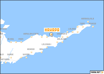
Nearby towns ::
Hiliwau (1.8km west) //
Lelehoa (2.6km south east) //
Wagahuhu (3.6km east) //
Mohiwa (3.6km east) //
Bailai (3.6km west) //
Walalaia (4.1km south east) //
Lelehudi (4.1km south west) //
Earoga (5.5km east) //
Biwa (5.8km east) //
Bou (6.6km south west) //
Wapulamutana (7.3km west) //
Guga (7.3km west) //
Hewiia (7.5km east) //
Lalako (7.5km east) //
Hehego (9.2km south west) //
[all distances 'as the bird flies' and approximate] 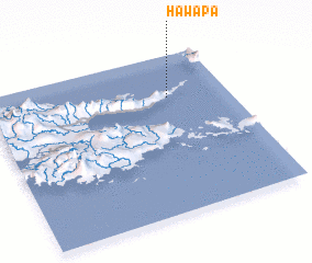 Places with similar names to Hawapa, Papua New Guinea :: Disclaimer :: Information on this page comes without warranty of any kind |
||
|
Where is Hawapa? Elevation and coordinates ::
Latitude (lat): 10°16'0"S Longitude (lon): 150°45'0"E
Elevation (approx.): 41m (map arrows pan, magnifying glasses zoom) |
||
|
Visiting Hawapa? Hotel/Accommodation ::
Book a hotel in Hawapa Travel Guide ::
rental cars ::
car rental offers GPS waypoint ::
download a GPX waypoint (PoI) of Hawapa for your GPS receiver
|
||