|
search place name
|
||
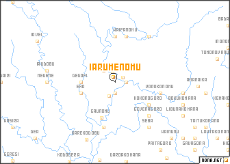
Iarumenomu (Papua New Guinea)Iarumenomu is a town in Papua New Guinea. An overview map of the region around Iarumenomu is displayed below.
regional and 3d topo map of Iarumenomu, Papua New Guinea ::
Iarumenomu airports ::
The nearest airport is POM - Port Moresby Jacksons Intl, located 64.2 km west of Iarumenomu.
Nearby towns ::
Bulidobu (1.4km north east) //
Dirinomu (1.4km north) //
Nemonomu (1.8km east) //
Sisigolo (1.9km south) //
Nafenanomu (2.5km south) //
Tabunoma (2.6km north west) //
Gegofi (5.5km west) //
Busalamaga (5.8km west) //
Eho (5.8km west) //
Gaunomu (6.2km south) //
Debadegoro (6.6km south east) //
Kokorogoro (6.6km south east) //
Muianomu (7.4km north) //
Varakanomu (7.5km east) //
Waifanomu (7.6km north) //
Wairadobu (7.6km south) //
Boku (7.6km south) //
Geveragoro (7.8km south east) //
Seba (9.2km south east) //
Barataka (9.2km north east) //
[all distances 'as the bird flies' and approximate] 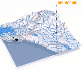 Places with similar names to Iarumenomu, Papua New Guinea ::
// Ieromními (GR)
Disclaimer :: Information on this page comes without warranty of any kind |
||
|
Where is Iarumenomu? Elevation and coordinates ::
Latitude (lat): 9°39'0"S Longitude (lon): 147°46'0"E
Elevation (approx.): 279m (map arrows pan, magnifying glasses zoom) |
||
|
Visiting Iarumenomu? Hotel/Accommodation ::
Book a hotel in Iarumenomu Travel Guide ::
rental cars ::
car rental offers GPS waypoint ::
download a GPX waypoint (PoI) of Iarumenomu for your GPS receiver
|
||