|
search place name
|
||
Kotidanga (Papua New Guinea)Kotidanga is a town in Papua New Guinea. An overview map of the region around Kotidanga is displayed below.
regional and 3d topo map of Kotidanga, Papua New Guinea ::

Kotidanga airports ::
The nearest airport is LAE - Nadzab, located 121.9 km north east of Kotidanga.
Other airports nearby include GKA - Goroka (160.5 km north west), HGU - Mount Hagen (256.5 km north west), Nearby towns ::
Hemieta (1.8km west) //
Ewai-Udidanga (1.8km west) //
Sugawianga (2.6km south east) //
Hauwambanga (3.7km north) //
Gemantua (3.7km east) //
Karangae (3.7km west) //
Iemepango (4.1km south west) //
Kaingo (4.1km south east) //
Wawbini (4.1km north east) //
Winga (5.2km south east) //
Wempangu (5.5km east) //
Pewabango (5.8km west) //
Hambia (5.8km east) //
Kwoi'imnga (6.7km north west) //
Ewinya (6.6km south west) //
Huwawia (6.6km north west) //
Yaa-Didimanga (6.6km north east) //
Ata (7.8km north west) //
Piwi'anga (7.8km north east) //
Mingia (8.3km south east) //
Yabona (10.4km south east) //
[all distances 'as the bird flies' and approximate] 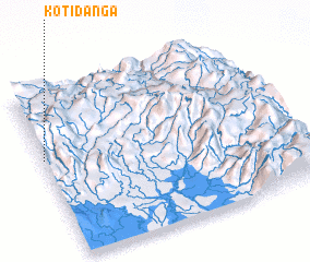 Places with similar names to Kotidanga, Papua New Guinea ::
// Catatonk (US)
// Kaytitinga (PH)
// Kota Tinggi (MY)
// Kadatuang (ID)
// Kotadonok (ID)
// Kotatangah (ID)
// Kotatangah (ID)
// Kotatengah (ID)
// Kotatengah (ID)
// Kotatinggi (ID)
Disclaimer :: Information on this page comes without warranty of any kind |
||
|
Where is Kotidanga? Elevation and coordinates ::
Latitude (lat): 7°24'0"S Longitude (lon): 146°0'0"E
Elevation (approx.): 1388m (map arrows pan, magnifying glasses zoom) |
||
|
Visiting Kotidanga? Hotel/Accommodation ::
Book a hotel in Kotidanga Travel Guide ::
rental cars ::
car rental offers GPS waypoint ::
download a GPX waypoint (PoI) of Kotidanga for your GPS receiver
|
||