|
search place name
|
||
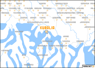
Kubalia (Papua New Guinea)Kubalia is a town in Papua New Guinea. An overview map of the region around Kubalia is displayed below.
regional and 3d topo map of Kubalia, Papua New Guinea ::
Kubalia airports ::
The nearest airport is WWK - Wewak Intl, located 31.5 km north east of Kubalia.
Nearby towns ::
Toanumbu (1.9km north) //
Soandogum (3.7km south) //
Mundjiharanji Villages (5.2km north west) //
Turingi (5.9km south) //
Turing (5.9km north) //
Maperinga (5.9km south) //
Nangumaru (6.7km north east) //
Hanyak 1 (6.7km north east) //
Uragambi (6.7km north east) //
Bararat (6.7km south west) //
Soandogum (6.7km south east) //
Numindagum (7.4km north) //
Sengoro (7.6km north) //
Haumbugwe Villages (7.6km north) //
Wambe (7.6km east) //
Wamoin (7.9km north west) //
Hanyak 2 (7.9km north east) //
Rabundogum (7.9km south east) //
Abauia 2 (8.3km north west) //
Yumungu (8.3km south east) //
Wangiakum (9.3km north east) //
Habiraka (9.3km north east) //
Chehovia (9.3km south east) //
[all distances 'as the bird flies' and approximate] 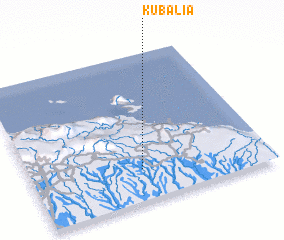 Places with similar names to Kubalia, Papua New Guinea ::
Disclaimer :: Information on this page comes without warranty of any kind |
||
|
Where is Kubalia? Elevation and coordinates ::
Latitude (lat): 3°47'0"S Longitude (lon): 143°28'0"E
Elevation (approx.): 128m (map arrows pan, magnifying glasses zoom) |
||
|
Visiting Kubalia? Hotel/Accommodation ::
Book a hotel in Kubalia Travel Guide ::
rental cars ::
car rental offers GPS waypoint ::
download a GPX waypoint (PoI) of Kubalia for your GPS receiver
|
||