|
search place name
|
||
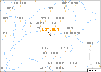
Lotuava (Papua New Guinea)Lotuava is a town in Papua New Guinea. An overview map of the region around Lotuava is displayed below.
regional and 3d topo map of Lotuava, Papua New Guinea ::
Lotuava airports ::
The nearest airport is POM - Port Moresby Jacksons Intl, located 114.5 km south of Lotuava.
Other airports nearby include LAE - Nadzab (208.0 km north), Nearby towns ::
Kaieri (1.9km north) //
Tarai (2.6km north east) //
Onete (4.1km north west) //
Dioro (4.1km north east) //
Lavavai (5.2km north west) //
Kiriai (5.5km east) //
Arione (5.9km south) //
Nionopu (5.9km north) //
Garipa (6.7km north west) //
Pobiaka (6.7km north east) //
Kone (7.6km south) //
Baidani (7.6km south) //
Tokyo (7.6km east) //
Favane (7.8km south east) //
Oro (8.2km north west) //
[all distances 'as the bird flies' and approximate] 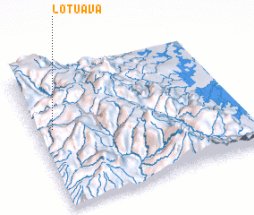 Places with similar names to Lotuava, Papua New Guinea ::
Disclaimer :: Information on this page comes without warranty of any kind |
||
|
Where is Lotuava? Elevation and coordinates ::
Latitude (lat): 8°25'0"S Longitude (lon): 147°5'0"E
Elevation (approx.): 1936m (map arrows pan, magnifying glasses zoom) |
||
|
Visiting Lotuava? Hotel/Accommodation ::
Book a hotel in Lotuava Travel Guide ::
rental cars ::
car rental offers GPS waypoint ::
download a GPX waypoint (PoI) of Lotuava for your GPS receiver
|
||