|
search place name
|
||
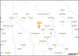
Ori (Sandaun, Papua New Guinea)Ori is a town in the Sandaun region of Papua New Guinea. An overview map of the region around Ori is displayed below.
regional and 3d topo map of Ori, Papua New Guinea ::
Ori airports ::
The nearest airport is WWK - Wewak Intl, located 141.3 km east of Ori.
Other airports nearby include DJJ - Jayapura Sentani (232.9 km north west), Nearby towns ::
Wuro (1.9km north) //
Boini (2.6km south east) //
Yuolpa (3.7km east) //
Munumbual (4.1km south west) //
Wowil (5.2km north west) //
Yirkin (5.9km east) //
Weiki Villages (5.9km north) //
Mai (6.7km south east) //
Yapunda (6.7km north east) //
Walgon (6.7km south east) //
Binara (7.4km south) //
Wosengim (7.6km south) //
Muku (7.9km north west) //
Surimorta (8.3km south east) //
Winbe (8.3km north west) //
[all distances 'as the bird flies' and approximate] 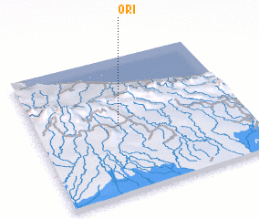 Places with similar names to Ori, Papua New Guinea ::
Disclaimer :: Information on this page comes without warranty of any kind |
||
|
Where is Ori? Elevation and coordinates ::
Latitude (lat): 3°30'0"S Longitude (lon): 142°24'0"E
Elevation (approx.): 446m (map arrows pan, magnifying glasses zoom) |
||
|
Visiting Ori? Hotel/Accommodation ::
Book a hotel in Ori Travel Guide ::
rental cars ::
car rental offers GPS waypoint ::
download a GPX waypoint (PoI) of Ori for your GPS receiver
|
||